
|
| Current weather at Coffee Bluff: |
Wind:
S at 0 mph G:0 | Max Wind:
0 at ---- | Temp:
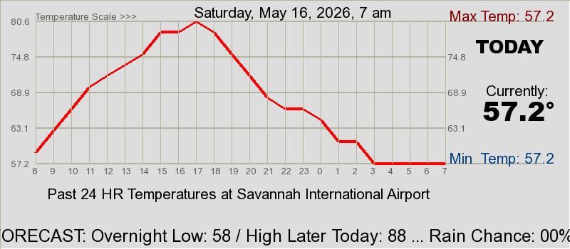
76.3 | Heat Index:
77 | Hum:
86% | Dew Point:
71.8 | Baro:
29.98 ↘ | Max:
79.2 | Min:
75.9 | Rainfall today:
0.00 | Time:
4:21a
|
Weather Information for SE GA / SE SC
Today is Saturday, July 4, 2026 ... Day 185 of the Year
|

ogeechgeemeatmarket.com
|
Pat's Forecast for SE GA / SE SC
It will be hot today through Wednesday with highs in the mid to upper 90s with the heat index around 100 today warming to around 102-108° Saturday and perhaps reaching around 110° Sunday through Tuesday. It will be mostly rain free this weekend with the daily late afternoon/evening thunderstorms returning early to mid next week.
The drought conditions continues to improve with the abundant rains of recent weeks. (See Drought Maps).
Normal High for Today is 92 and Normal Low is 73
Earliest sunrise occurred June 10-11 ... Latest sunset occurred June 29-30. Earth will be furthest from the sun (aphelion) on July 6 at a distance of 94,502,962 miles
Astronomy Video ... June 7 ... A Tour of Globular Clusters of Stars
Saturday
Jul 4 | Daytime High: 97°
Overnight Low: 77°
Rain Chance: 30% | Partly cloudy hot and humid. Highs will be in the mid 90s and low in the mid 70s. The heat index will be around 103-108°
|
|---|
Sunday
Jul 5 | Daytime High: 99°
Overnight Low: 77°
Rain Chance: 30% | Partly cloudy hot and humid with a slight chance for showers and thunderstorms. Highs will be in the upper 90s and low in the mid 70s. The heat index will be around 105-110°
|
|---|
Monday
Jul 6
| Daytime High: 98°
Overnight Low: 78°
Rain Chance: 30% | Partly cloudy hot and humid with a slight chance for showers and thunderstorms. Highs will be in the upper 90s and low in the mid 70s. The heat index will be around 105-108°
|
|---|
Tuesday, Jul 7
Daytime High: 98°
Overnight Low: 77°
Rain Chance: 30%
| Wednesday, Jul 8

Daytime High: 97°
Overnight Low: 77°
Rain Chance: 40%
| Thursday, Jul 9
Daytime High: 96°
Overnight Low: 77°
Rain Chance: 50%
| Friday, Jul 10
Daytime High: 97°
Overnight Low: 78°
Rain Chance: 40%
| Saturday, Jul 11
Daytime High: 97°
Overnight Low: 77°
Rain Chance: 40%
|
See the FORECAST RAIN CHANCES/AMOUNTS ... FORECAST TEMPERATURES ... and the FORECAST CLOUDS & WINDS for your area
Beach Water Temperatures are around 86°F (30.0°C)
Weather Discussion:
A complete & comprehensive meteorological discussion is available from the National Weather Service, Charleston and from the NWS, Jacksonville, FL
Temperature & Precipitation Outlooks: 6-10 Days ...
8-14 Days
Pat's 6 Week Weather Outlook
WEEK 1
Jul 3-Jul 10
Above Normal
Normal High = 92 ... Low = 73
Precip: Below Normal
Normal: 1.19" per week)
|
WEEK 2
Jul 11-Jul 17
Above Normal
Normal High = 92 ... Low = 74
Precip: Slightly Above Normal
Normal: 1.19" per week)
| WEEK 3
Jul 18-Jul 24
Slightly Above Normal
Normal High = 93 ... Low = 74
Precip: Around Normal
Normal: 1.26" per week)
|
|
|
WEEK 4
Jul 25-Jul 31
Above Normal
Normal High = 92 ... Low = 74
Precip: Slightly Below Normal
Normal: 1.47" per week)
|
WEEK 5
Aug 1-Aug 7
Slightly Above Normal
Normal High = 92 ... Low = 73
Precip: Around Normal
Normal: 1.54" per week)
|
WEEK 6
Aug 8-Aug 14
Slightly Above Normal
Normal High = 91 ... Low = 73
Precip: Around Normal
Normal: 1.47" per week)
|
|
|
|
This is not a forecast but just an 'outlook'. Keep in mind, the 7 day period is the average of those days with some days above the values and other could be below the values. This is used to get a better idea as to what to expect (maybe).
|
|
Radar Views
|
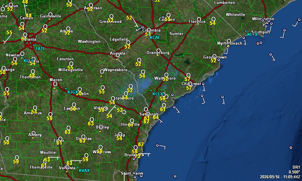
Doppler Radar Level 3 Data
From KCLX ... Grays, SC ... NWS, Charleston
|
|
... Click on Radar for Animation & More Products ...
|
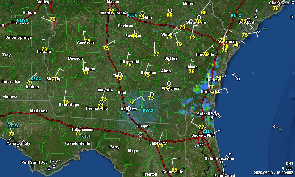
Doppler Radar Level 3 Data
From KJAX ... NWS ... Jacksonville, FL
|
|
... Click on Radar for Animation ...

|
Realtime Lightning Display
|
|
|
|
|

Looking for a hosting service for your web page? A2 Hosting would be a good choice
 Send our comments to Patrick Prokop ... patprokop49@gmail.com
Visitors to this page:
...
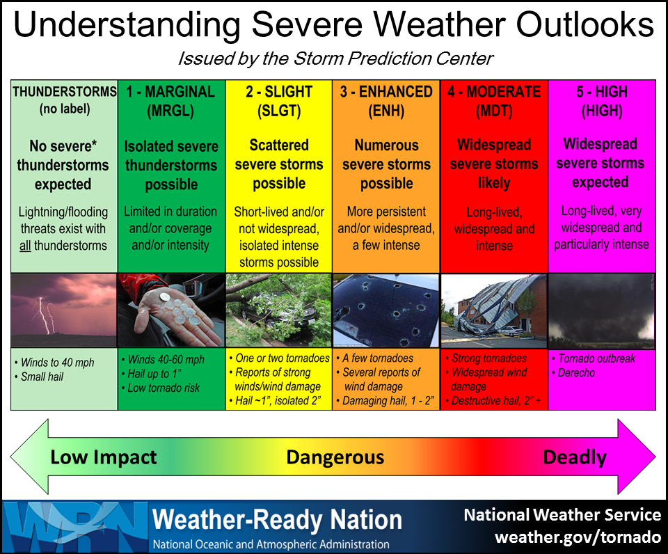
 Severe Weather Outlook


 Asbury Memorial Church ...


